Map of the voyage of the USS Aquarius
during World War II.
Path drawn by Donald Gustafson, CQM
Click on the full map thumbnail to see a 162k JPEG version of it.
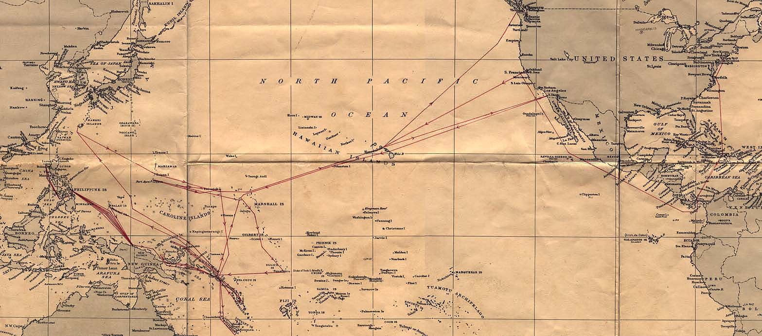
To view the Pacific half of the map only (from Hawaii westward), click here.
To view the North/Central American section of the map, click here.